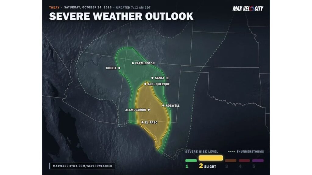
Supercells Could Erupt Around El Paso, Las Cruces and Alamogordo as Saturday Storms Threaten Large Hail, Damaging Winds and a Possible Tornado
EL PASO, TEXAS — Southern New Mexico and far West Texas faced a threat of large hail, damaging winds and even a possible tornado on Saturday, October 24, 2026, as a storm system spinning over Arizona pushed a burst of energy across the region.
What Was Driving the Storms
A storm system over Arizona sent energy northeast across New Mexico and West Texas. With temperatures climbing into the 80s, the warm air gave developing storms extra fuel.
Timing of the Threat
| Time | What to Expect |
|---|---|
| Before noon | Warming temperatures into the 80s |
| After noon | Storms begin firing around Las Cruces, El Paso and Alamogordo |
| Afternoon | Some storms could become supercells |
| After about 7 p.m. | Threat fades as conditions cool off |
Risk Levels Across the Region
The severe weather outlook split the area into two main risk zones:
- Level 2 (Slight Risk): A corridor from near Albuquerque south through Roswell and down to El Paso, stretching into far West Texas
- Level 1 (Marginal Risk): A wider area reaching north to Santa Fe, Farmington and Chinle
The Main Hazards
Storms in the higher-risk zone around Las Cruces, El Paso and Alamogordo could turn into supercells, bringing:
- Large hail
- Damaging winds
- An isolated tornado, especially if storms stay separate from one another instead of merging into lines
Hail Possible Farther North
Up north, scattered storms around Albuquerque and Santa Fe could also produce some hail before weakening into the evening hours.
Safety Reminders for Severe Storms
Residents in the risk areas were urged to:
- Move vehicles into garages or under cover to avoid hail damage
- Stay indoors and away from windows when storms hit
- Have a plan to reach an interior room if a tornado warning is issued
- Keep weather alerts on through the evening until storms fade
Stay with Bchssreport.com for the latest updates on this story.
About The Author
