Philadelphia, New Jersey and Eastern Pennsylvania Face Small Chance of a Brief Tornado Thursday Afternoon as Low-Pressure System Brings Storms and Soaking Rain
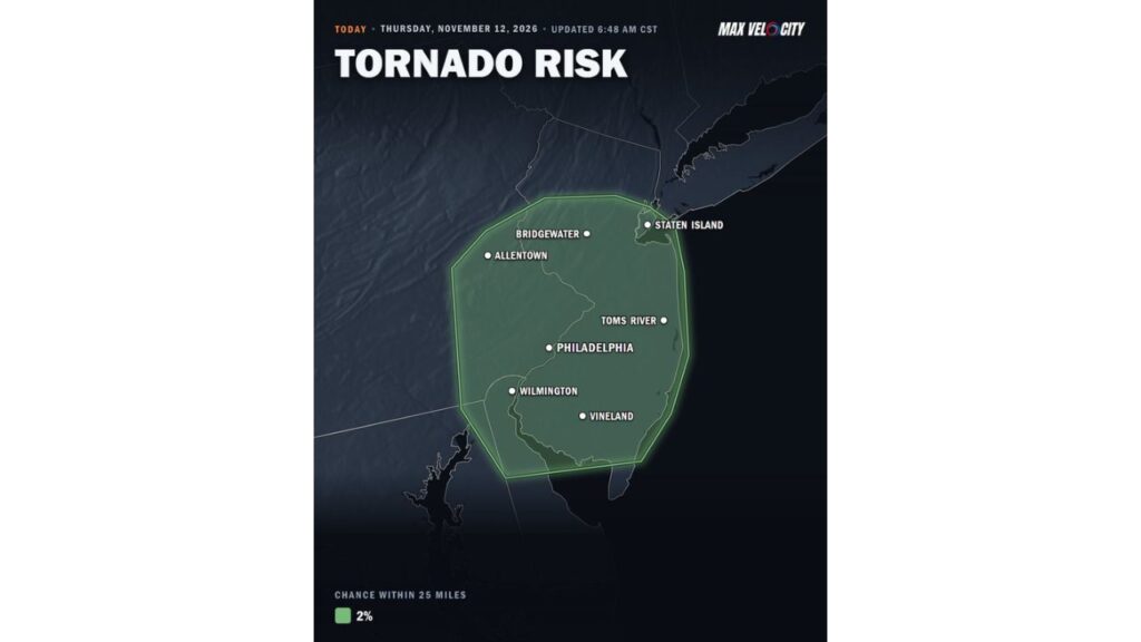
PHILADELPHIA, PENNSYLVANIA — A brief tornado cannot be ruled out Thursday afternoon, November 12, 2026, across eastern Pennsylvania and New Jersey, including the Philadelphia area.
The tornado threat comes as a low-pressure system moves into the Northeast, bringing rain and some thunderstorms to the region.
Tornado Risk Details
| Detail | Information |
|---|---|
| Date | Thursday, November 12, 2026 |
| Outlook updated | 6:48 a.m. CST |
| Timing | Thursday afternoon |
| Tornado chance | 2% within 25 miles of any point |
| Main threat area | Eastern Pennsylvania, New Jersey, northern Delaware and Staten Island |
Cities Inside the Risk Area
The highlighted zone includes several major cities and towns:
| State | Areas in the Risk Zone |
|---|---|
| Pennsylvania | Philadelphia, Allentown and nearby suburbs |
| New Jersey | Bridgewater, Toms River, Vineland and much of central and southern New Jersey |
| Delaware | Wilmington and northern Delaware |
| New York | Staten Island |
What a 2% Tornado Risk Means
A 2% tornado risk is the lowest probability typically shown on tornado outlooks. It means:
- Tornadoes are not expected to be widespread
- A brief, weak tornado is possible in a few storms
- Most areas will not see a tornado
Even so, short-lived tornadoes can still cause damage, so residents should stay alert.
Same System Bringing Heavy Rain to the Northeast
The storms are tied to a low-pressure system forecast to bring rain from Thursday afternoon through Friday evening. Expected totals include:
| Area | Expected Rainfall |
|---|---|
| New York City, Long Island and coastal New Jersey | 0.5 to 1.5 inches, isolated 2 inches |
| Philadelphia, Allentown and the Hudson Valley | 0.5 to 1.5 inches |
| Reading, Lancaster and northern Delaware | 0.25 to 0.5 inch |
| Northeast Pennsylvania | Rain changing to snow, up to 3 inches at higher elevations |
Why Storms Could Rotate
As the low-pressure system moves in, warm, moist air near the coast can combine with changing winds with height. That setup can sometimes allow storms to briefly rotate, even in November.
Possible Hazards Thursday Afternoon
Along with a brief tornado, storms could bring:
- Gusty winds
- Heavy downpours
- Ponding on roads and highways
- Reduced visibility for drivers
Tornado Safety Reminders
- Keep weather alerts on during the afternoon
- Know your safe place, such as a basement or interior room on the lowest floor
- Move indoors if storms approach
- Avoid driving into heavy rain or storms
Commute Impacts Possible
Storms and rain could make for a messy evening commute across Philadelphia, New Jersey and the New York City area. Drivers should allow extra time and watch for flooded roads.
Colder Air Follows the Storm
After the system moves out, colder air will spread across the Northeast, with snow showers possible in the mountains and gusty winds continuing into the weekend.
Stay with Bchssreport.com for the latest updates on this story.
About The Author
