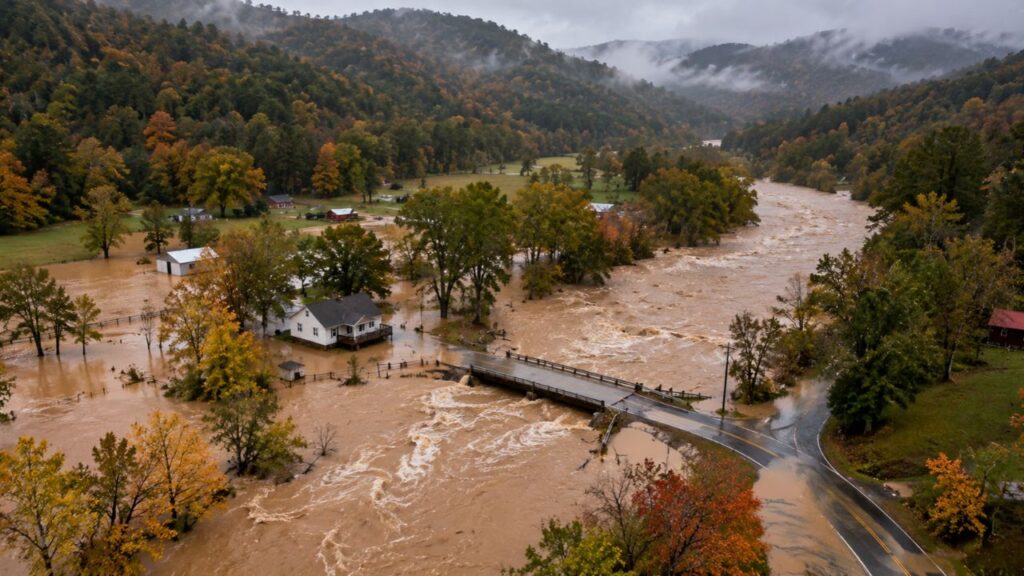
North Georgia’s Appalachian Foothills Soaked by Up to 7.12 Inches of Rain as Hours of Training Downpours Keep Flash Flood Emergency in Place
NORTH GEORGIA — One small but extremely unlucky area of northern Georgia has been hammered by hours of training downpours, with radar estimating up to 7.12 inches of rain in the hilly terrain of the Appalachian foothills.
A Flash Flood Emergency remained in effect late Wednesday night, November 4, 2026, as water continued to pour into creeks and low-lying areas.
What “Training” Storms Means
Training happens when storms move repeatedly over the same area, like train cars passing along the same track. Instead of a storm passing through quickly, rain keeps falling on the same spot for hours, causing totals to pile up fast.
Radar Estimates 7.12 Inches in 12 Hours
| Detail | Information |
|---|---|
| Peak Radar-Estimated Rainfall | 7.12 inches |
| Time Period | 12 hours ending 11 p.m. EST Wednesday, November 4 |
| Location | Appalachian foothills of north Georgia |
| Data Source | MRMS radar combined with rain gauges |
| Alert Status | Flash Flood Emergency continues |
Bullseye Between Dalton and the North Georgia Mountains
The heaviest rain fell inside the flash flood emergency zone, located east of Dalton and north of Dahlonega, covering parts of Fannin and Gilmer counties. Earlier reports from the area included mudslides and water rescues.

Rain Totals Drop Sharply Outside the Hardest-Hit Zone
| Area | Approximate 12-Hour Rainfall |
|---|---|
| Flash flood emergency zone | Up to 7.12 inches |
| Areas around Dalton and Chattanooga | About 2 to 3 inches |
| Upstate South Carolina northwest of Greenville | About 2 to 5 inches |
| Knoxville and East Tennessee | About 1 to 2 inches |
| Asheville area | About 1 to 2 inches |
| Dahlonega, Toccoa and Gainesville | About 0.5 to 2 inches |
| Atlanta, Marietta and Athens | Under 1 inch |
| Huntsville and Gadsden | Mostly under 1 inch |
Second Heavy Rain Band Over Upstate South Carolina
A separate band of heavier rain also stretched across the Upstate of South Carolina, northwest of Greenville, with totals of 2 to 5 inches in spots. Areas near Walhalla were also included in flash flood warnings.
Atlanta Largely Spared
Despite the extreme totals just to the north, the Atlanta metro saw much less rain, mostly under an inch, showing how narrow and focused the heaviest rainfall was.
Why Hilly Terrain Makes Flooding Worse
The Appalachian foothills are especially vulnerable to flash flooding:
- Steep slopes send water rushing downhill quickly
- Narrow valleys funnel water into creeks and roads
- Soaked hillsides can trigger mudslides
- Mountain roads often follow streams, putting drivers at risk
Safety Steps While the Emergency Continues
- Stay off the roads unless evacuating
- Move to higher ground if water threatens your home
- Avoid creek crossings and low spots
- Watch for mudslides near steep slopes
- Keep emergency alerts on throughout the night
Outlook: Flooding Threat Continues Overnight
With water still draining off the mountains, creeks and streams may stay high even after the rain eases. Residents in north Georgia should remain alert until officials say the danger has passed.
Stay with Bchssreport.com for the latest updates on this story.
About The Author
