
Increased Risk of Landslides and Debris Flows Across the North Carolina Mountains This Weekend as Isaias Remnants Could Dump 5 to 10 Inches of Rain
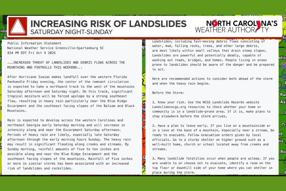
Western North Carolina – The National Weather Service is warning of an increasing risk of landslides, rockslides, and debris flows across parts of the North Carolina mountains and foothills this weekend. As the remnants of Hurricane Isaias move north, heavy tropical rain is expected to be forced up the mountains, especially near the Blue Ridge Escarpment and the southeast-facing slopes of the Balsam and Black Mountains. Rainfall totals of 5 to 10 inches are possible in these areas by Sunday morning, and the greatest danger is expected Saturday night into Sunday.
Isaias Remnants Track West of the Mountains
After Hurricane Isaias made landfall over the western Florida Panhandle on Friday evening, the center of the storm’s remnant circulation is expected to move north, passing west of the mountains on Saturday afternoon and Saturday night.
On this track, a strong southeast flow will push a large amount of tropical moisture directly into the mountains. When that moist air hits the steep slopes, it’s forced upward, which squeezes out heavy rain. This upslope effect is why the heaviest rain is expected along the Blue Ridge Escarpment and on the southeast-facing slopes of the Balsam and Black Mountains.
Timing of the Heavy Rain
Rain is expected to develop across the western Carolinas and northeast Georgia early Saturday morning. It will then increase in intensity along and near the escarpment during Saturday afternoon.
Periods of heavy rain are likely, especially from late Saturday afternoon through the early morning hours of Sunday. This is the period when the risk of flooding and landslides will be highest.
5 to 10 Inches of Rain Possible
By Sunday morning, rainfall amounts of 5 to 10 inches are possible along and near the Blue Ridge Escarpment and the southeast-facing slopes of the mountains. Communities in this zone include areas around Hendersonville, Lake Lure, Marion, Brevard, and the higher terrain of Transylvania, Henderson, Rutherford, McDowell, Buncombe, Haywood, and Jackson counties.
The heavy rain could also cause significant flooding along creeks and streams, which can rise very quickly in steep mountain terrain.
Why 5 Inches of Rain Raises the Landslide Risk
According to the National Weather Service, rainfall of five inches or more in similar storms has been linked to an increased risk of landslides and rockslides in the North Carolina mountains. When soil becomes saturated on steep slopes, it can lose its strength and suddenly give way.
Landslides, including fast-moving debris flows made up of water, mud, falling rocks, trees, and other large debris, are most likely within small valleys that drain steep slopes. These events are powerful and potentially deadly, and they can wash out roads, bridges, and homes with little warning.
A Region That Knows the Danger
Western North Carolina has experienced devastating landslides in the past during heavy tropical rain events, including Hurricane Helene in 2024. Many residents remember how quickly conditions changed during that storm. While this event isn’t expected to match Helene, the heavy rain in the most vulnerable areas makes landslides a real concern.
Know Your Risk
The North Carolina Geological Survey offers landslide hazard maps that show whether homes and communities are in landslide-prone areas. Residents are encouraged to check these resources before the storm. If your home is in a high-risk area, make plans to stay somewhere else before the heavy rain arrives.
Have a Plan to Leave Early
Anyone living on a mountainside or in a cove at the base of a mountain, especially near a stream, should be ready to evacuate. Follow evacuation orders from local officials, and don’t wait until conditions get worse.
The safest place to go is a sturdy shelter on higher ground, such as a well-built home, church, or school located away from creeks and streams.
Danger While Sleeping
Many landslide deaths happen when people are asleep. Since the heaviest rain is expected overnight Saturday into Sunday, this is especially important. If you can’t or choose not to evacuate, identify a room on the top floor or on the downhill side of your home where you can shelter in place during the storm.
Have Multiple Ways to Receive Alerts
Residents should have more than one way to receive alerts, especially overnight Saturday into Sunday. Turn on emergency alerts on your cell phone and sign up for local emergency alerts from your county’s emergency management office. A NOAA Weather Radio is another reliable way to get warnings while you sleep.
Warning Signs of a Landslide
Signs that a landslide may be developing include sudden changes in creek water levels, especially if a stream rises quickly or becomes muddy, or if water levels suddenly drop even though it’s still raining. Other signs include unusual sounds, such as trees cracking or boulders knocking together, along with new cracks in the ground, pavement, or foundations.
If you notice any of these warning signs, move to higher ground immediately, away from the path of the potential slide.
Never Drive Through Flooded Roads
Heavy rain could flood roads and wash out sections of pavement in the mountains. Never drive through flooded roads, and be careful on mountain highways, where rockslides and debris could block travel lanes. If possible, avoid travel in the mountains during the heaviest rain.
For more western North Carolina weather updates and Isaias coverage, stay with bchssreport.com.