
North Carolina Heads Toward Near-Record Heat Before a Weekend Cold Front Brings Rain, Cooler Air, and Possible Trouble for Outdoor Weddings
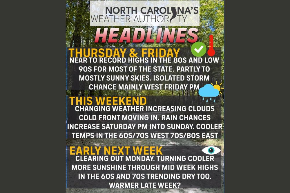
North Carolina – North Carolina is in for a weather rollercoaster over the next several days. Thursday and Friday will feel like summer, with near-record highs in the 80s and low 90s for most of the state. Then a cold front moves in for the weekend, bringing increasing clouds, rain chances, and much cooler temperatures. For the many couples who picked the first weekend of October to get married, it may be time to finalize that backup plan.
Thursday and Friday: Summer Returns
High pressure will dominate the weather on Thursday and Friday, keeping skies partly to mostly sunny across much of the state. Temperatures are expected to climb into the 80s and low 90s for most locations, putting some areas near record highs for early October.
It will definitely feel more like summer than fall. Anyone heading outdoors during the afternoon should be ready for warm conditions, especially in the Piedmont, Sandhills, and Coastal Plain, where the warmest readings are likely.
Humidity Creeps Back Up
Along with the heat, humidity will increase somewhat by the end of the week. The more humid air will make the afternoons feel even warmer and could also help fuel a few storms by Friday evening.
Isolated Storms Possible Friday Evening
While most of Thursday and Friday will stay dry, a couple of pop-up showers or storms are possible late Friday afternoon and evening. These storms are expected to develop mainly across the western half of the state, including the mountains and foothills. Most areas will stay dry, but anyone with Friday evening plans in western North Carolina, including high school football games, should keep an eye on the sky.
Saturday: Dry Start, Rain Arriving Later
The pattern changes over the weekend as a cold front moves into North Carolina. Saturday should start off fairly dry for most areas, but clouds will increase through the day. Scattered showers are expected to spread across the state during the afternoon and evening.
There is still some uncertainty in the timing, as some forecast models have been trying to slow the front down. Even so, anyone with outdoor plans late Saturday afternoon and evening should be prepared for rain at times, especially farther west in the state, where the rain is expected to arrive first.
Saturday Night Into Sunday: The Wettest Period
Saturday night into Sunday looks like the wettest stretch of the weekend, with scattered to numerous showers at times across North Carolina. This is the period when outdoor events are most likely to be affected.
How Much Rain Could Fall?
Rainfall totals are still all over the place in the forecast models. Some show several inches of rain through Monday, while others show much less. The current thinking is that totals will range from around 0.25 inches to 3 inches across the state, with the highest amounts in the west. This forecast is still highly fluid, and there is a chance the final totals could come in lighter than some models suggest.
Either way, the rain would be welcome for many areas that have been dry recently.
Much Cooler Weekend Temperatures
The cold front will bring a big drop in temperatures. On Saturday, highs will range from the 60s and 70s in western North Carolina to the 70s and low 80s in the eastern half of the state, where the front will arrive later.
By Sunday, the entire state will turn cooler, with highs mostly in the 60s and 70s. After the near-record warmth of Thursday and Friday, the change will be very noticeable.
Weekend Weddings and Outdoor Plans
The first weekend of October is a popular time for weddings and other outdoor celebrations across North Carolina, and the timing of this front is not ideal. Anyone with outdoor plans, especially from Saturday night into Sunday, should have a backup plan or arrange for tents or covered areas in case showers move through. Fall festivals, football tailgates, and youth sports events could also be affected.
Early Next Week: Clearing, Cooler, and Drier
Once the front moves through, conditions will clear out on Monday. The rest of the early week will turn cooler and drier, with more sunshine and highs in the 60s and 70s for most of the state through midweek. It will be a true taste of fall, with comfortable afternoons and crisp mornings.
Warmer Again Late Next Week
The cooler stretch may not last long. Toward the end of next week, temperatures could begin warming back into the 70s and 80s for most areas, though that part of the forecast is still a few days out.
Stay Tuned for Weekend Updates
With timing and rainfall amounts still uncertain, the weekend forecast could change over the next couple of days. Residents with outdoor plans should keep checking for updates as the front gets closer.
For more North Carolina weather updates and weekend forecasts, stay with bchssreport.com.