
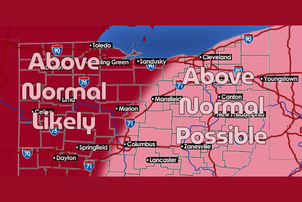
Above Normal Temperatures Look Increasingly Likely for Northern Ohio as Hurricane Polo Remnants and Southerly Winds Set Up a Warm Stretch Before a Sharp Cold Front
Northern Ohio – Northern Ohio is about to get a taste of summer again. A stretch of above normal temperatures is becoming more and more likely across the region, with several weather ingredients lining up to push warmer air into the state during the final days of September and the start of October.
Why Northern Ohio Is Warming Up
A big part of the warm-up comes down to where Ohio sits in the larger weather pattern. The region is expected to be on the western side of a developing high-pressure system, which means upper-level winds could flow in from the south to southwest. That setup acts like a conveyor belt, carrying warmer air straight into the Buckeye State.
Hurricane Polo Remnants Could Add Extra Heat
Adding another layer to the forecast are the remnants of Hurricane Polo. As that leftover tropical energy gets pulled into the broader weather pattern, it could strengthen warm air advection as a warm front lifts northward through the region. This combination could give the area an extra boost of warmth over a day or two.
How Warm Will It Get?
Most locations are expected to see highs in the upper 60s to low 70s, which is above normal for this time of year. A day or two could even bring temperatures into the mid 70s in some spots. Western and northwestern Ohio, including areas around Toledo, Bowling Green, Lima, Marion, Springfield, and Dayton, are in the zone where above normal temperatures look most likely. Farther east, including Cleveland, Mansfield, Canton, Youngstown, Columbus, Zanesville, and Lancaster, above normal temperatures are possible as well.
Storm Track Will Decide the Final Numbers
There is still some uncertainty in the forecast. The exact path of the Polo remnants and the developing low-pressure system will play a major role in how warm it actually gets. If the system brings in thick cloud cover, temperatures could be held back. If skies stay sunnier and the southerly flow is stronger, highs could climb even higher than currently expected.
The warmer-than-normal period is currently expected to last from roughly September 29 through October 3.
A Sharp Cold Front Waits on the Other Side
The warmth will not last forever. Behind the developing low-pressure system, a potent cold front could sweep across Ohio, bringing a much colder air mass into the region. That could lead to a dramatic temperature swing, taking Northern Ohio from summer-like afternoons to a true fall chill in a short amount of time.
Enjoy the Warmth While It Lasts
With tropical remnants, a warm front, strong southerly winds, and a sharp cold front all in the mix, the coming week is shaping up to be an interesting one for weather watchers. Residents may want to make the most of the warm days for outdoor plans before the colder air settles in.
For more Ohio weather updates and forecast changes, stay with bchssreport.com.