
Connecticut Shivers Through a Chilly, Breezy Tuesday With Highs Only in the 60s Before Frost Tonight and a Warmup to the 70s by Thursday
Connecticut – It is a chilly Tuesday across Connecticut. The day started with temperatures in the 30s and 40s, and a brisk northwest wind of 15 to 30 mph will keep it feeling cool all day long despite plenty of sunshine. Highs will only reach the 60 to 65 degree range. Tonight into early Wednesday, frost is possible in some areas, but a nice warmup is on the way, with some spots climbing into the 70s by Thursday.
A Cold Start to the Day
Many residents woke up to a crisp, chilly morning, with temperatures in the 30s and 40s across the state. Inland areas and higher elevations, especially in Litchfield County and northeastern Connecticut, were among the coldest spots. Areas closer to the shoreline, including New Haven, Bridgeport, and New London, started out a bit milder but still cool.
Anyone heading out early needed a warm jacket, and many drivers likely had to deal with chilly cars and foggy windshields.
Sunny Skies All Day
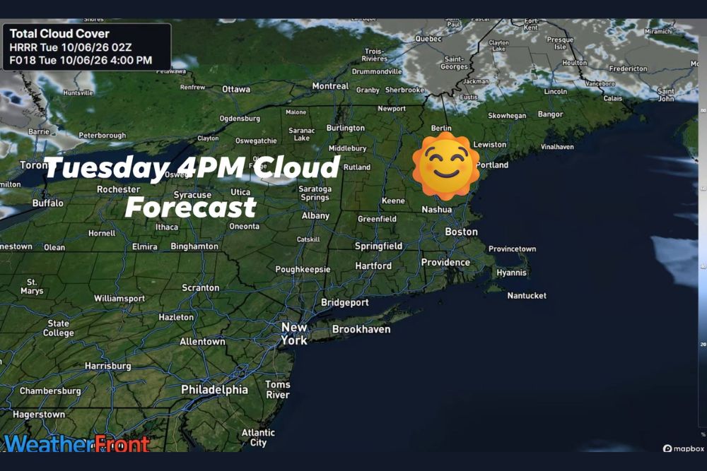
The good news is that Tuesday will be sunny. Forecast cloud cover maps show mostly clear skies across Connecticut and much of the Northeast through the afternoon, including Hartford, Springfield, Providence, Boston, and New York City. Only a few clouds are expected far to the north in parts of Quebec and northern New England.
The bright sunshine will make for a beautiful fall day to look at, even if it feels cooler than it appears.
Brisk Northwest Wind Adds a Chill
A northwest wind of 15 to 30 mph will make the air feel even cooler on Tuesday. Gusty winds can make temperatures in the 60s feel more like the 50s at times, especially in open areas and along the shoreline.
The wind could also send leaves flying and blow around loose outdoor items, so residents may want to secure lightweight decorations and patio furniture.
Highs Only in the Low to Mid 60s
Despite the sunshine, highs on Tuesday will only reach about 60 to 65 degrees across the state. That is a few degrees below average for early October and a noticeable change from the warmer weather earlier in the season.
Frost Possible Tonight Into Early Wednesday
As skies stay clear and winds calm down overnight, temperatures will drop quickly. Frosty areas are expected tonight into early Wednesday, especially in inland valleys, rural areas, and northern and northwestern Connecticut, where temperatures could fall into the 30s.
Gardeners should take steps to protect sensitive plants. Covering plants with sheets or frost cloth, or bringing potted plants indoors, can help prevent damage. Any remaining tomatoes, peppers, or herbs may need to be harvested before the cold night.
Drivers should also plan a few extra minutes Wednesday morning to scrape frost off windshields.
Warming Into the 70s by Thursday
The chill will not last long. After a cool start on Wednesday, temperatures will begin to warm up, and some areas could reach the 70s by Thursday. The warmer air will make for a pleasant stretch of fall weather, perfect for outdoor activities.
Great Week for Fall Activities
With sunshine and comfortable temperatures ahead, it is a great week to enjoy fall in Connecticut. Apple picking, pumpkin patches, hiking, and leaf peeping are all great options. Fall colors are starting to pop, especially in northern Connecticut and the hills of Litchfield County.
Time for Fall Home Prep
Cold mornings and frosty nights are a good reminder to start preparing for the colder months. Now is a great time to check heating systems, replace furnace filters, clean gutters as leaves begin to fall, and disconnect garden hoses before freezing temperatures become more common.
Enjoy the Crisp Fall Weather
While Tuesday may feel chilly, the sunshine and fall colors make it a great day to get outside with an extra layer. The warmer air later in the week will offer a nice balance between crisp mornings and comfortable afternoons.
For more Connecticut weather updates and local forecasts, stay with bchssreport.com.